Wednesday, June 12, 2013

Scenic start, off-roading in the middle, Babe the Blue Ox, a big scary climb, and a fantastic end to our day

Friday, May 25, 2012 - Day 9

We woke up, ate a little breakfast, packed our gear and James did some necessary bike maintenance (lubed the chains, tightened my headset, etc).  On our way out we stopped by the Visitors Center.  We met a couple from Michigan who had started in Seattle and was heading south to San Fran.  That definitely seems to be the popular direction.  We had heard from the other cycle tourers that they had seen 4 other people heading north.


We left Prairie Creek Redwood State Park and headed north on the Drury Scenic Parkway.  The bike tourists who shared the campground rode in on it and said it was very pretty, low traffic, and a must ride.  James had already planned to take it on our route and their feedback reaffirmed it was a good decision.

The Newton B. Drury Scenic Parkway is a 10 mile stretch that was full of redwoods, ferns, and a mix of vegetation that made it very pretty.  It definitely met the promises of our cycling friends.  Cyclists who take it heading South are rewarded with a nice 3-4 mile descent.  Because we were going north, we got to climb.  It wasn't a difficult climb and it made for a nice warm-up for my legs. After climbing most of the parkway we had the option of continuing and getting on Hwy 101 or taking the Coastal Range road that is closed to cars.  The Coastal Range road is an abandoned road that starts out with asphalt then turns to broken asphalt, then turns into a bike path, then single track, then nothing where one has to hike a bike, then back to some gravel, then broken asphalt, then full asphalt.  To be blunt -- I do not recommend anyone who is touring this route to take this road unless you have good tires and a need for adventure.  It isn't for the faint of heart.  It did provide some nice views of the ocean and it ended outside of Klamath, CA. 


Klamath, CA has an interesting history.  In the photo below, I'm at the historical bridge that used to cross the river that brought visitor's into the town of Klamath.  The bridge was noted for the two bears that were at the entrance of the bridge, one on each side.  The photo I have only shows one of the bears.   If I remember correctly, the flood of 1964 was a 100-year flood that submerged the town of Klamath and destroyed the bridge.  They tore down the bridge except for what is shown in the picture and rebuilt a new entrance into town.  As you can see in the next photo the the townspeople made sure that the new bridge had bears welcoming guest like the old bridge only they had them painted gold.


We stopped at the Log Cabin Diner for lunch/brunch.  We parked our bikes along a fence and the ostriches in the neighboring field were quite curious about our transportation and came to say hello.


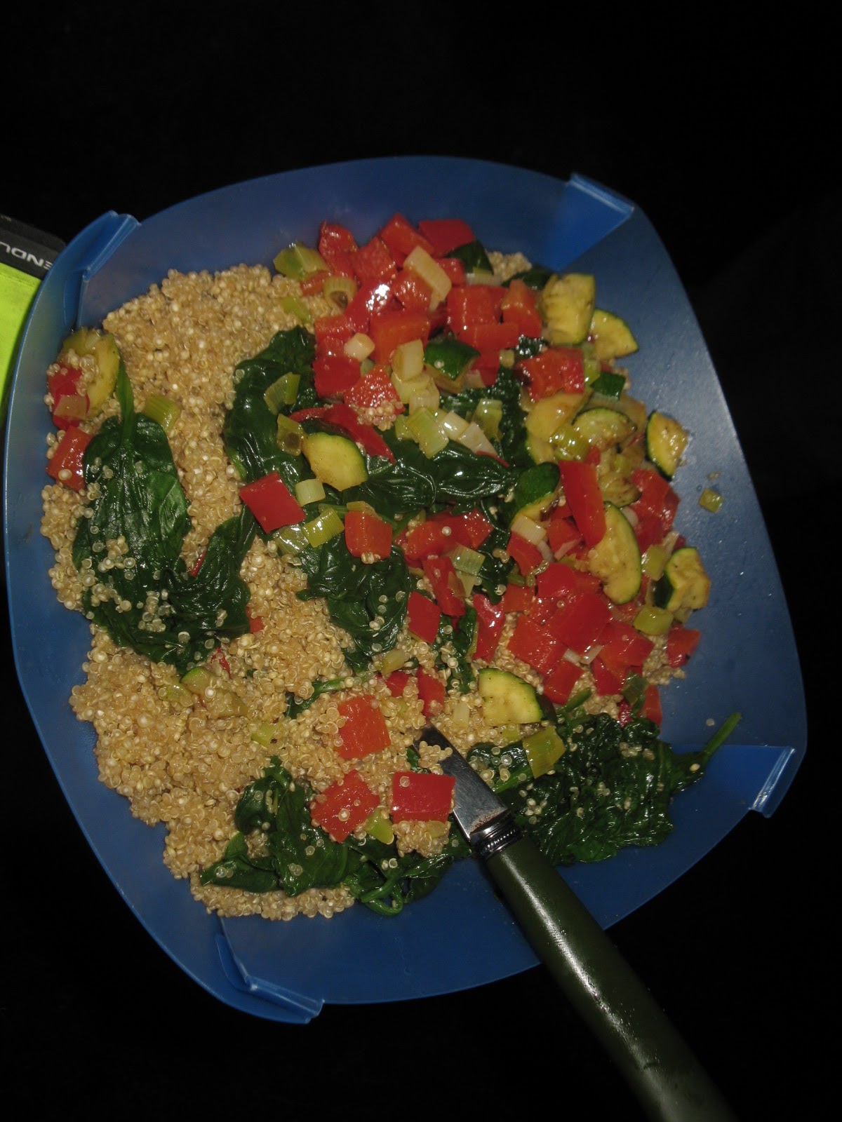
The diner served basic food.  I ordered a big bowl of New England Clam chowder and two sausage and egg burritos and a coffee for breakfast/lunch.  This was a new trick that I had learned.  I don't like eating a big breakfast after I get up so I would eat just enough to get me going.  Then we would ride 1-2 hours and stop at a restaurant for breakfast.  By then I was ready to eat a lot of food and kcals that could help sustain me for the rest of the day.  So I'm sitting and eating my large breakfast and the other thing I started to notice was the people around me were eating similar portions to me.  I knew they weren't going out and riding a loaded bike for 50-60 miles.  My guess they were going to their jobs and sitting.  I was eating a lot of kcals -- no wonder people in our country are so big!  They don't realize how many kcals they are eating and how little they actually expend.

We continued north and briefly stopped at the entrance to the "Trees of Mystery" and saw Paul Bunyon and Babe the Blue Ox.  Paul would talk to the visitors as they approached the giant statue.  It was quite hilarious.
After we left the "Roadside America" tourist attraction, we were committed to Hwy 101 for the rest of the way into Crescent City, CA.  We didn't have any other options.  There was a shoulder most of the time, two lanes of traffic but the cars, trucks, semi-trucks still blew by us at 65+ miles per hour.  A lot of the time the trucks/semi-trucks with trailers wouldn't move over into the left lane.  It was really scary and very unnerving.  To get into Crescent City required a substantial climb over a mountain range.  I clocked it at 5-6 miles and I believe it was a 1200 ft climb.  To make matters worse they were doing road construction on part of it so we had to deal with the stop and go of a one lane highway.  This road was very tight in spots and didn't have much of a shoulder on this section.  It was very unnerving.  James noted that it seemed like the shoulder was wider heading south.  We finally got to the top and descended into Crescent City.  By this time in the trip I had gotten pretty good at handling my bike going down hill while fully loaded and I went as fast I could while staying within my limits -- I believe I topped out at 40 mph.  I just wanted to get off that road!

Crescent City, CA is a really nice sized town (about 8K) right off the coast.  We had strong headwinds going into town.  The Tsunami of 2012 had impacted it and we could see some of the remnants of the damage.  The stores also had a lot of before and after photos that were interesting to see.  James' bike rack was broken so we went to Home Depot so he could buy a part. We ended up talking to one of the workers who had a mullet.  He was a really nice guy with an interesting history.  James had seen him driving a fork lift and heard a string of obscenities leave his mouth and immediately went to ask him where we should get dinner.  He recommended a great local seafood restaurant called the Chart Room.  The Chart Room was right on the dock of the bay and there were seals lying on the docks.  We had a view of the ocean and wonderful seafood with decent sized portions.  We both would go again if we were ever in Crescent City.


We filled our tummies and James then took us the "back" way to Jedediah Smith State Park via Howland Hill road.  I was not very happy about this route in the beginning.  To get to Howland Hill road required a steep climb out of town and while climbing it I sounded like the fork lift driver we met at Home Depot. Once we got to the top and entered the forest it was totally worth it.  Howland Hill road was one of the most scenic roads during the trip and definitely the most beautiful gravel road either of us have ridden.  It was hard packed, curvy, and giant Redwoods everywhere. James had read that the oldest living Redwood lived in the forest but it's location wasn't made known to the public to preserve it.  I'd definitely go back and ride that road again if I have the chance.  Unfortunately the pictures I have below don't capture the awesomeness of this road.


Given the fact it was the Friday of Memorial Day weekend I was a little worried about getting a camping spot.  The nice thing about riding in on a bicycle in the CA state park system (Oregon as well), bicyclists are guaranteed a spot. They just squeeze as many people into a camp spot as they can.  In Jedediah Smith State Park the biker/hiker spot is way back in the picnic area and is very private.  In fact we were a good distance from all of the Memorial Day car campers, which was awesome!  We rolled into the bike area and we were the only bikers in the biker section and no one showed up for that evening.  We set up our tent in the middle of some Redwoods which also happened to be next to the Smith river.  I couldn't believe it, the Friday of Memorial Day weekend we were camping by ourselves - away from all of the car campers, looking up at Redwoods and listening to the sound of flowing water.  So peaceful.  I'd rank this as my all time favorite state park in CA.

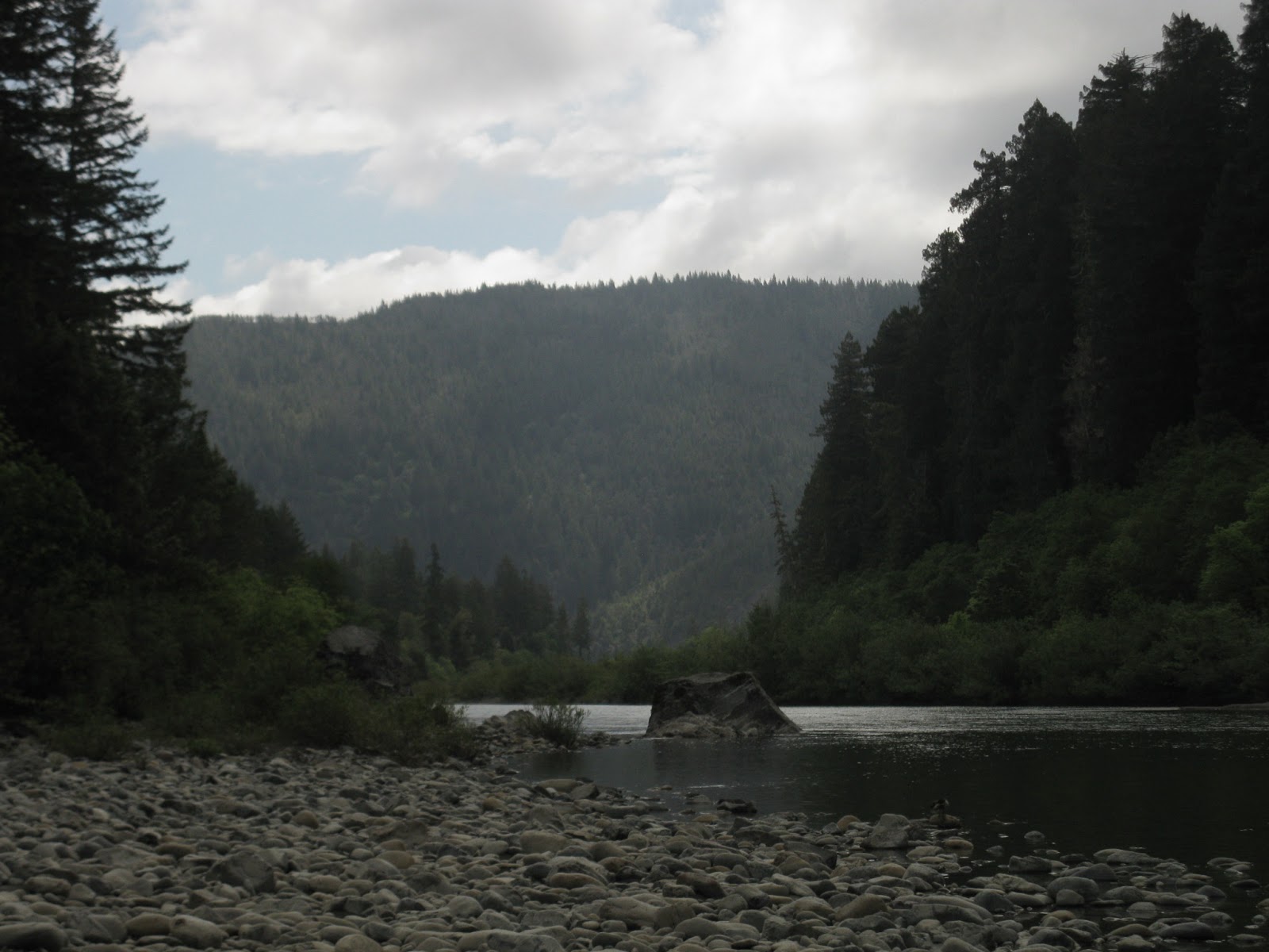
Tomorrow we cross the CA border into OR.

Total miles for the day:  56 miles
Total for the trip: 528 miles


Tuesday, June 11, 2013

One week of touring and energy levels have dropped!

Thursday, May 24, 2012 - Day 8

We woke up to cooler temperatures and rain.  I snuggled deeper into my sleeping bag not wanting to get up and get wet.  James was a trooper and got up and got breakfast going.  We had purchased eggs and cheese at a local grocery while we were in McKinleyville, CA.  I was snuggled in my sleeping bag and all of the sudden a hand reached into the tent holding a wonderful cup of hot coffee.  Five minutes later it was back with a hot egg and cheese sandwich.   James is awesome.  I thoroughly enjoyed my wonderful breakfast and coffee, warm dry, and in the tent.  I finally dragged myself out of bed, got dressed and helped James pack up our gear and we headed north.

It rained for most of the time, Hwy 101 was busy and it didn't have much of a shoulder in places, and the traffic didn't seem to bother to slow down.  It was sketchy.  James found a back road that was parallel to Hwy 101 and we took it.  It had some rollers on it and I was really tired at that point.  Fortunately we had already planned to have a short day.

Hwy 101

Backroad
The back road we took came out on Hwy 101 again and it was really close to a convenience store.  This was one of those stores that has everything in it -- groceries, prepared food, milk, basic cleaning supplies, etc.  We were on a stretch of isolated highway and I think this was a place the locals got food items when their bulk purchases ran out.  I told James that my legs were beat and I was just exhausted.  I remember he asked me if my legs were tired or if my whole body was tired and my response was my whole body was tired.  He told me he could see the exhaustion in my eyes.

My body was craving sugar.  I've never had such a craving for sugar in my life.  I went into the store and purchased one of those single serving bowls of Fruit Loops and bought a quart of Chocolate Milk.  I poured the chocolate milk on the Fruit Loops and ate it.  James looked at me like I was nuts but asked how it tasted.  I decided I would never do it at home but it tasted really good at the time.  That wasn't enough sugar so I bought a package of Keebler fudge rounds and we both downed the entire packaged in 5 minutes. 


We left the convenience store and cruised to the nearest State Park -- Prairie Creek Redwoods State Park.  We passed through a town on our way but it was run down and I would not have wanted to sleep in any of the hotel rooms.  Prairie Creek State Park was really nice.  It was quite a ride to get to the hike/bike section and the showers were not close but never-the-less, it was a stopping point.  It is actually a really nice park.  It has majestic Elk that show up and hang out in the meadows in the early evening and morning hours.  There are signs everywhere telling the campers how to behave around them.  We set up camp and I immediately went to bed and slept really hard for 2 hours.  James in the mean time went exploring on his bike and found some really neat trails, beautiful country, saw several Elk and some really big slugs.  I've provided a preview of the amazing photos he took during his excursion.


While I was asleep some bicycle tourers showed up and set up camp near James and my campsite.  I had a lovely conversation with them and we exchanged stories about where we had been, the good places to eat, good grocery stores, etc.  One of the cyclists was a female engineer who was doing her tour solo.  She started in Washington State and was heading to San Francisco and then taking the train back.  The other cyclists were a couple from Ithaca, NY who were biking from one daughter who lived in Seattle, WA to the other daughter who lives in San Francisco, CA.  Neither daughter rides and they indicated they thought they were crazy.  I learned that they had done a lot of touring before they had kids and now that their kids are grown and on their own they are beginning to tour again.  I think this means James and I will have plenty more tours in our future!


getting more creative with my camp stove cooking
I learned from this trip that it is important to have planned rest days where either the distance is short (in our case 25 miles) or don't ride at all.  While I was eating food, we were riding so much that it was hard for me to stay up with my energy output.  Eventually my appetite had become suppressed and I wasn't finishing my meals and my kcaloric deficit became greater.  I was able to sustain a good output for a couple of days but eventually my inadequate kcal consumption caught up to me.  That is why I had such an intense craving for the simple sugars.  My body just wanted to be fed.  The rest day was exactly what I needed and I was able to close my kcalorie gap.  In addition the food I ate above, I had a Coke and a Hershey's chocolate bar with almonds which ended up becoming a staple in our daily meal.  I also figured out that we were covering some big distances compared to our touring peers.  They were going 30-40 miles a day.  We were averaging 65 miles a day.  James called our touring "performance touring".  I believe it.

Total miles for the first week of riding:  470 miles.


Rolling along to our destination: Patrick's Point State Park

Wednesday, May 23, 2012 - Day 7

Today was just a day to cover distance. We spent most of our time on back roads and didn't have much a view of the ocean.  The ocean along Hwy 101, when we were near it, was ok...it wasn't a deep blue as what we have been seeing during our tour on Hwy 1. 

We got up at a reasonable hour and went to the convenience store attached to the Inn we were stayed in and picked up some sausage, egg, and cheese biscuits and juice for breakfast.  We then headed out of Ferndale towards Eureka, CA.   It was one of the last towns that we knew we could get camp fuel for quite awhile.  The sun was shining and we didn't have strong headwinds.

Ferndale, CA


     When we arrived in Eureka, CA we immediately went to the local bicycle shop, Henderson Bicycles, to find out where get food.  That is one thing that I've learned after years of traveling with James.  If you want to find the best food, the best place to go is the local bicycle shops.  They owners always know of the good local food joints.  We were directed to the Oaxaca Grill on 508 Henderson street.  The owner was super friendly and it was obvious he was trying to build his business and he really wanted to make his customers happy.   We ate a giant burrito, fresh salsa, a tasty mole sauce with a Mexican Coke.  Mexican Coke is made with sugar rather than high fructose corn syrup and it tastes less sweet -- the amount of simple sugars in the Mexican Coke close to "American" Coke though.  After eating our burritos we ran into a bakery where James picked up some fresh bread that they sliced for us and we took with us.


We then headed across town to a sporting goods store / bicycle shop called Adventures Edge to get camp fuel and to look around.  The guys at the shop were really nice and when they found out we had climbed "The Wall" they were quite impressed.  While I was there I picked up a souvenir.  My arm warmers I took with me were too warm for the the temperatures while I was riding but it was too cold and breezy to go without.  So I bought a long sleeved synthetic blend shirt and it served me very well during the rest of the trip.  Note to self:  next time I tour the coast in May and June, take a couple of long sleeve synthetic shirts.  The bicycle shop folks gave us a directions to a new bike path that would keep us off of Hwy 101.  Granted going this way meant we covered a little more distance since it was the less direct route but we prefer to avoid the busy Hwy 101 and to stay off it as much as possible.  In fact, we didn't go into Arcata, CA at all.

What we did was cross the bridge that went over Arcata Bay by taking "R street" out of town.  Once we crossed the bridge we turned right on New Navy Base road and traveled on some back roads until we connected with the bike path called "Fischer road" that took us into McKinleyville, CA.  The bike path runs alongside Hwy 101 until Clam Beach State Campground -- it isn't much of a campground and we didn't stay there but we did stop to have a snack.  The roads were quite flat compared to what we did the day before, very low traffic, and it was quite pleasant.  I was glad we made the decision to stay off of Hwy 101.
 

We rolled into Patrick's Point State Park and the camping for hiker/bikers was located on the cliffs above the ocean.  We couldn't see the ocean but we could definitely hear the ocean as we camped that night.  We were able to take a short hiking trail and watch the sunset on the ocean.  I must say camping near an ocean beats staying in a hotel any day.


We rode 57 miles for the day and have a total of 445 miles on our legs for this trip.


Monday, June 10, 2013

"The Wall"


Tuesday, May 22, 2013 - Day 6

James and I had oatmeal and coffee for breakfast packed up our tent and other gear and started on our big day of climbing.  In fact the amount of climbing we had on our schedule for the day was pretty intimidating to me.  We road 2 miles out of the campground and immediately started the first climb:  7 miles, 1700 feet -- a great way to start our 64 miles for the day.  It was a nice steady climb with a few steep switch backs.  In retrospect I probably should have slowed down my pace on that climb given the fact we had 2 more big climbs ahead of us.
Leaving the campground
Climbing
at the top of climb #1


After getting to the top we were rewarded with a really fun and long descent that dropped down into Honeydew, CA and stopped at the general store (immediately to the right after crossing the bridge).  There isn't anything else to Honeydew.  In fact, I don't think they have any other buildings other than the general store. We purchased some food, chocolate milk, and a Coke to get us through the next 2 climbs we had on our agenda for the day.

We saw a cyclist climbing up the mountain and later had a chance to talk with him at the general store in Honeydew, CA.  We decided he was the Rick Beville of Honeydew (its a Lexington, VA reference).  Anyway, he had time to climb up and down that mountain everyday and he seemed to be a strong rider.  Doing that climb every day would definitely do it.  He asked us where we were headed, James told him we were headed to the Lost Coast and he looked at us, our loaded bikes, and said, wow, you are going to do "The Wall?".  We said yes.  I went to the bathroom and ran into another local and he asked me where we were going.  I told him the Lost Coast and his response was the same, "you are going to do "The Wall"?  By this time I'm starting to get a little panicked.  I remember James telling me something about a steep climb but didn't realize it was sandwiched in between 2 major climbs.

So we climb out of Honeydew and head toward the Lost Coast.  The Lost Coast is about a 2 miles stretch of road that is basically undeveloped. The terrain was too rugged for Hwy 101 to be put in and so the Department of Transportation took it inland, east of the Lost Coast.  Unfortunately it was cloudy and drizzling the day we were there but I can image that it is absolutely gorgeous on a sunny day.  The ocean was a grey/green different from the brilliant blue we had been exposed to prior to this.  There were pretty white and yellow wild flowers decorating the side the road.  There was relatively no traffic - I think we saw 5 cars the time we were there.  It is empty coast line and a couple of ranches with cattle on the inland side.

So, to get out of the Lost Coast requires climbing a road that the locals refer to as "The Wall".  It is a one mile climb that has grades of 18-22%.   I later learned that there is a century ride that goes through this area called the "Tour of the Unknown Coast"  California's toughest century.

James and I get closer to "The Wall" and there are a herd of cattle on the right.  I swear they starting moving with us to the end of the lot so they could get a better view.  It was like they were saying to each other "hey, check these two out.  They think they can climb the wall carrying 50# pounds of gear. This ought to be good."  A car came down the wall as we were nearing it.  I was watching it and got butterflies in my stomach wondering if I was going to make it up without having to get off and walk.
approaching "The Wall" - it gets steeper after the right curve


finishing the steep part
Fortunately James put mountain bike gears on my touring bike and I got in my granny and made it just fine.  James made it without any problems -- which is not a surprise.

After climbing the wall we descended about 900 feet and then started the next major climb.  I think it was about 8 miles and the first 3 miles ranged from 15%-17% and then it turned into a nice steady climb which I later learned is referred to by cyclists as the "Endless Hill".  I must say that I agree with the name they have given that climb. It started out as a drizzle and by the time we were 2 miles up the climb it started raining pretty steadily.  The terrain reminded me of the pictures I see of Ireland.  Really lush green grass, rolling hills, bright red barns.  It was beautiful.  It would have been nicer had it not be raining though...I was starting to get soaked and I was worried about having dry clothing for the next day.

still climbing

descending into Ferndale, CA

We finally reached the top and descended into Ferndale, CA.  It was raining, cold, and there was big diesel truck with a trailer on my tail which was a little unnerving given the fact the descent was windy and steep and it was wet.  We finally rolled into Ferndale, CA which is a charming little town.  James wanted to check out the county fairground outside of town.  I told him I was fine with him going but I was getting a hotel room.  I was tired, cold, wet, and just wanted a hot shower and to sleep in a bed.  So we found a cute little Inn and the man who owned it, it turns out used to live in Woodstock, VA which is close to where James and I lived when we were in VA.  He gave us a discount on the room.


We ate the local pizza place.  I ordered a lot of food but couldn't eat it all. The lasagna was good but the pizza wasn't the best pizza -- I prefer less cheese. The restaurant did have some funny decorations though.  There was a laundry mat a couple of blocks from the Inn and so we took the opportunity to wash our clothes.


Ferndale, CA is a charming little town and the rhodendron were in full bloom when we were there.  If I do the trip again it would have been fun to explore a little bit.

We did a total of 64 miles for the day. After looking at the "Untouched Coast Century" map, I think we did all of the major climbs that are in the century and the total vertical is 9400 feet.  I'm guess we did pretty close to that amount.  Our total for the trip is 388 miles.